
The shape of the land is our best clue to buried peat carbon
New research shows that terrain data can improve maps of peat depth in Norway while airborne radioactivity measurements fall short.
Peatlands are among Earth's most powerful carbon stores. A single square meter of bog or fen can hold more carbon than the same area of tropical rainforest — locked in layers of peat that have been building for thousands of years. How much carbon a peatland stores depends on one thing above all: depth. And right now, Norway lacks good maps of that depth.
A new study by researchers in the Repeat project, published in the journal SOIL, tested different ways of predicting peat depth from the air. Across two contrasting Norwegian landscapes — Ørskogfjellet in Møre og Romsdal and Skrimfjella in Buskerud — the team measured peat depth at over 2 000 locations and compared predictions from LiDAR-based terrain models against airborne radioactivity measurements. The verdict: the shape of the land wins.
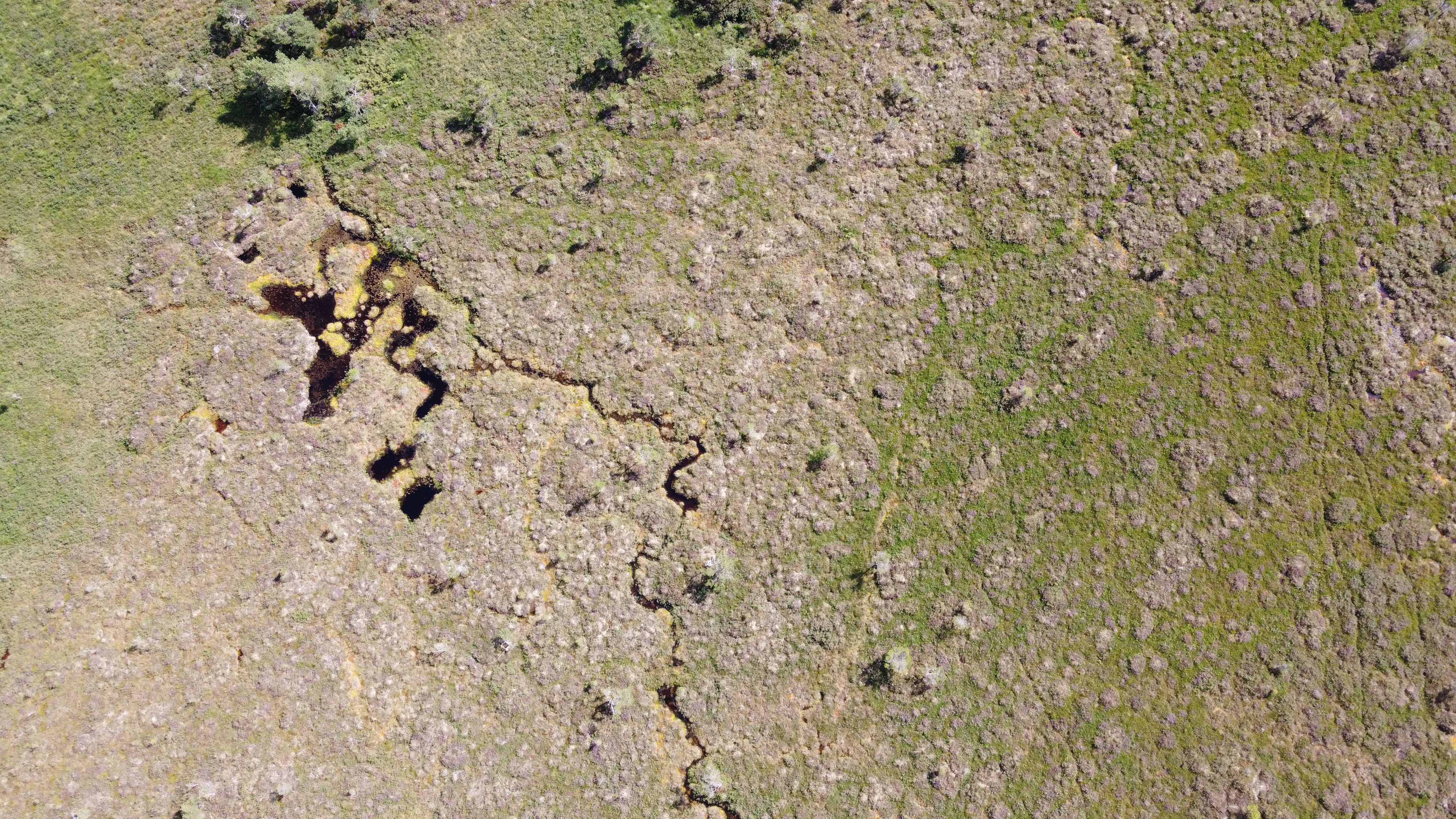 Aerial view of a peatland surface at Ørskogfjellet, showing the small pools of an intact peatland. Photo: Sigurd Daniel Nerhus
LiDAR maps the surface of the peat, not the mineral ground beneath — yet surface topography still carries signals of where peat tends to be deep or shallow. The most powerful predictor was a measure of valley bottom flatness: flat, low-lying positions in the landscape had the deepest peats, probably because they hold water and accumulate organic matter over millennia. Peat is also deeper where the land has been above sea level longest since the last ice age — at Ørskogfjellet, depths increased sharply above 75 metres, right where the old marine shoreline sat.
Airborne radioactivity had a different logic: thick peat absorbs natural radiation from the bedrock beneath it, so areas with deep peat should register lower radioactivity from above. A promising idea — but the helicopter-borne sensor sees a footprint more than 100 metres wide, far too blurry to capture depth variations that can span metres within a few steps.
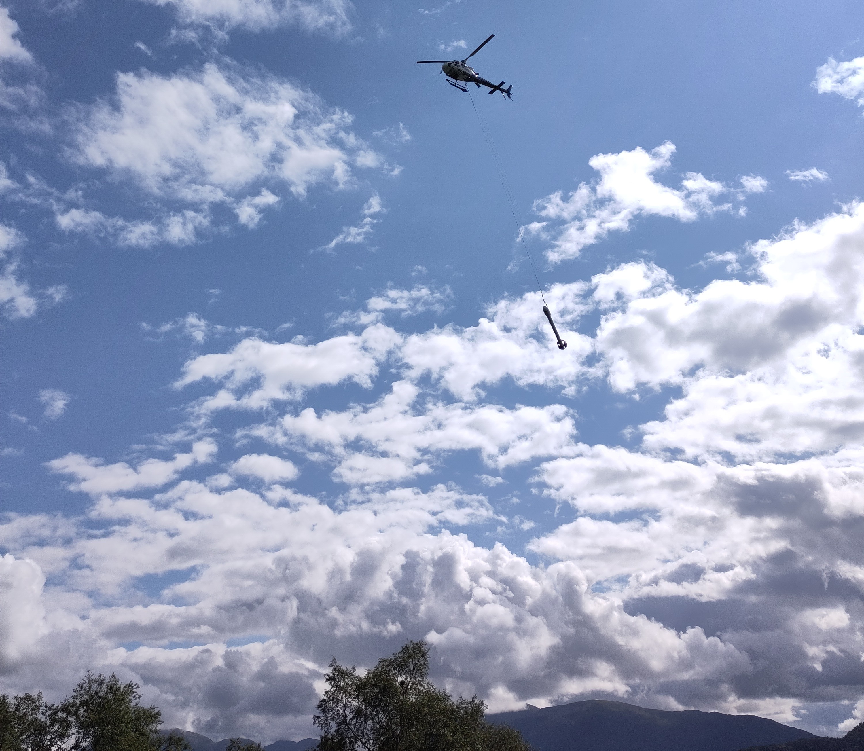 This helicopter is collecting data for a geophysical survey in western Norway. The instrument's height above the ground limits its ability to capture peat depth. Photo: Julien Vollering
The terrain-based maps beat Norway's existing national peat depth map, which classifies depth as just shallow or deep, leaves large parts of the country as unknown, and cannot distinguish a 1 m peat from a 5 m peat. The new maps give continuous estimates at 10 m resolution across the full landscape. They still miss by about 60 cm on average, and tend to underestimate the very deepest peats — so for small, specific areas, field measurements remain essential. But for landscape-scale carbon accounting and steering roads or buildings away from carbon-rich pockets, they offer a meaningful step forward. The next step is to get field measurements collected and shared more systematically, so maps like these can be made across more of Norway.